
Original price was: $14.95.$10.76Current price is: $10.76.
- There are quality problems, free return and exchange
- Quality products, fair prices.
- Discover a world of quality products.
- Quality and Affordability Combined

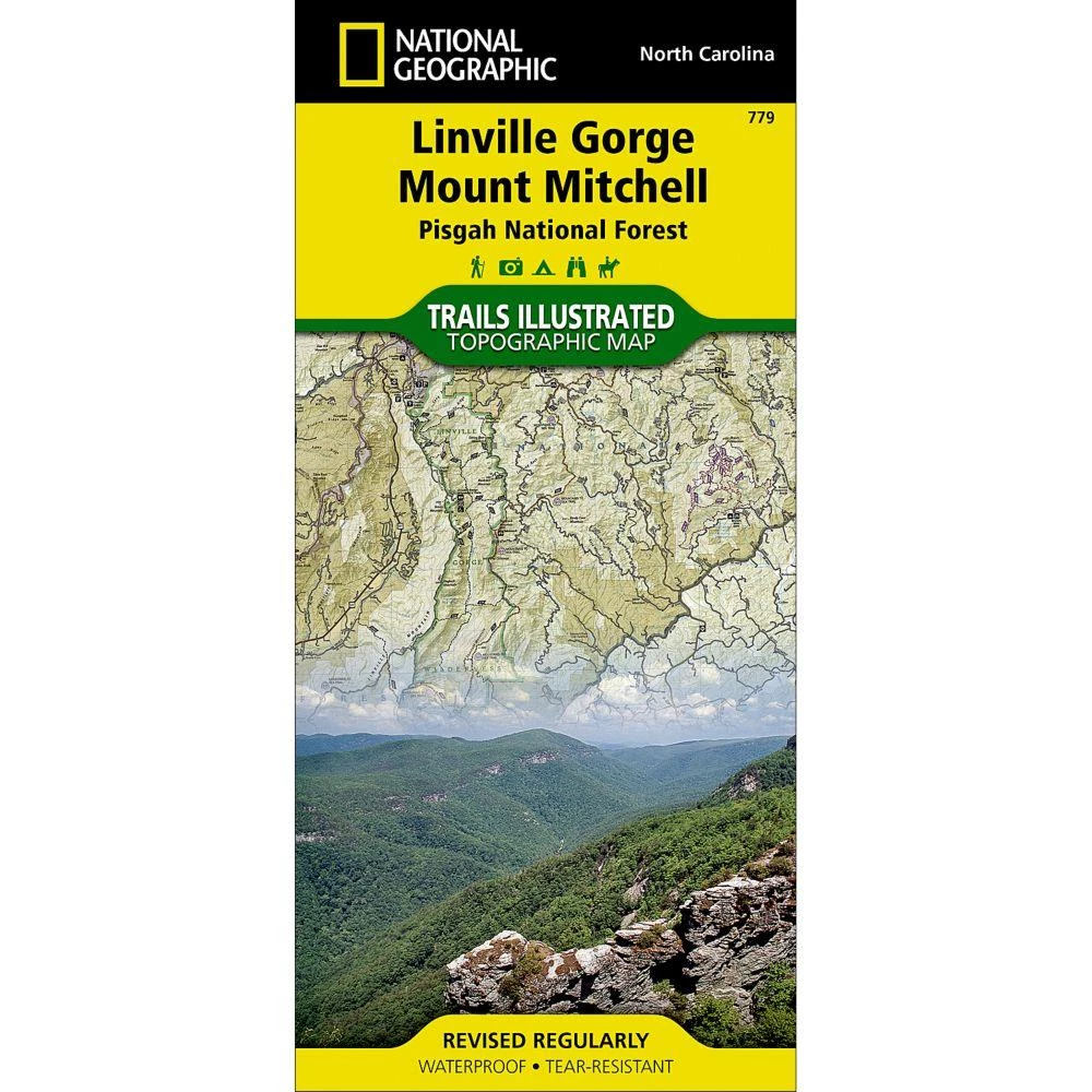
Expertly researched and created in partnership with local land management agencies, National Geographic’s Trails Illustrated map of Linville Gorge and Mount Mitchell provides an unparalleled tool for exploring these remarkable features within Pisgah National Forest. This map includes such key areas of interest as Linville Gorge Wilderness, Mount Mitchell State Park, Craggy Gardens, Grandfather Mountain Biosphere Reserve, Lake James State Park, and Brown Mountain OHV Area. Whether you’re exploring on foot, or by horse, bike, or motorized vehicle, you’ll find this map an invaluable resource for exploring the miles of mapped trails and roadways within the region, including the Appalachian National Scenic Trail, Mountains-to-Sea Trail, and Blue Ridge Parkway. An extensive chart with the location, mileage, rating, and designated use for dozens of trails and a handy activity guide will help you make the most of your visit. Recreation features are clearly marked, including campgrounds, po…
| Condition | New |
|---|
Be the first to review “Second Gear WNC National Geographic Map – Linville Gorge & Mt. Mitchell #779”
Related products


Backpacks & Bags
Backpacks & Bags

Backpacks & Bags
Second Gear WNC Hike Mountainsmith Trippin’ Fanny Pack, Mint


Backpacks & Bags
Reviews
There are no reviews yet.